 We went out on Sunday to explore a little. We hadn’t been in Conway for probably 30 years. Needless to say it had changed a lot, and one addition was the Conway scenic railroad. The restored, old time equipment they have is really impressive. I was surprised to learn that it had only been in operation since 1995. They run two train excursions, and we opted for the one up Crawford notch . This one didn’t run till Tuesday, the inevitable result of this kind of trip. The weather was a little cloudy, but, much worse was predicted for the future so we opted for the guided trip to the top of Mt Washington today.
  At the base the weather looked perfect at the top. 53 degrees with a 20 mile wind and 43 with the wind chill. The visibility was 90 miles, our guide said they only get a few days a year like this one! We started crossing the Appalachian trail, and looked over our shoulder UP to the top of wildcat mountain ski area We would later look down on it!. Our guide told us that the climate proceeds 100 miles further north for every 1000 ft we gain in altitude. We quickly moved through the Canadian forest zone and up to the next one, It was a zone made up of stubby pine trees, 2-3 ft high. Around this transition zone we reached a patch of dirt road that was barely two vehicles wide. This is where the restrictions came from.
 This patch washes out every spring, and they could not keep pavement on it. There were deep gullies on either side, and the company keeps a crew of rescue drivers on hand to step in for people who just get too scared and can’t drive any further. I would have loved to take the truck up it, but wouldn’t have wanted to miss the views from the passenger seat either. As we approached the summit the ground just was covered with rocks and moss and lichens. We were told there is permafrost a few inches down.
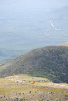
 When we got to the summit (6288ft.) the view was spectacular. There were many hikers with their day packs and climbing paraphernalia. We saw the Tip Top house a restored lodge for days gone by that provided a cot, and a meal for adventurers who made it to the top. The Mt. Washington auto road is the oldest man made attraction in the US.
  Besides the antenna and the weather station sensors, there is the old weather station, where the US’s highest wind speed ever was recorded, 231 miles per hour. The building is chained to the ground, because there is no foundation for it.
The cog railroad was just leaving for a trip down the mountain. It was interesting to watch it pass the hikers on the way up and view the scenery it was leaving. I've got so many pictures form this trip I just didn't know what to include. When we got down we toured their collection of old vehicles. They have conducted tours in everything from stage coaches to Packards to the vans they use today.

No comments:
Post a Comment